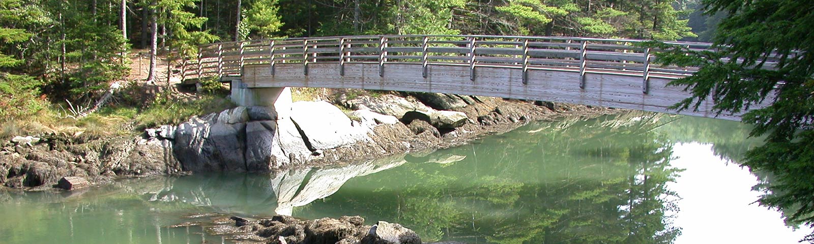
Ovens Mouth Preserve is comprised of two distinct peninsulas connected by a pedestrian bridge. This preserve features BRLT’s most extensive trail system with over 5 miles of hiking trails in total. Both the East and West sections of Ovens Mouth are heavily wooded and feature partial water frontage and shoreline trails, quiet coves, and salt marsh, as well as stunning areas for picnicking, nature studies and watching the dramatic tidal change of the Ovens Mouth passage.
Both peninsulas are home to a variety of wildlife, including eagles, osprey, otters and deer. The East and West sections of Ovens Mouth Preserve are connected by a 93-foot pedestrian bridge which provides excellent views of the waterways as well as the opportunity for more extensive hiking across the trail system. Dogs must be leashed at all times at Ovens Mouth.
Ovens Mouth East is a wooded, hilly property on 60 acres. Its easy trails include a 1.1 mile loop trail through woods with plenty of scenic water views along the Back River, as well as a shorter .5 mile wooded trail ending in a scenic view of the Back River. Winter snowshoeing is also popular here.
Ovens Mouth West, on 86 acres, provides more challenging hiking on 3.6 miles of trail. The longest stretch of trail on the west side is a 1.75 mile loop trail through woods and along the shore. There are a number of intersecting shorter trails as well that provide a variety of hiking options on this extensive preserve.
The Ovens Mouth passage, bordered on the north by the town of Edgecomb and on the south by Boothbay, is a narrow waterway leading from the Sheepscot and Back Rivers to an extensive tidal basin. In 1994 Boothbay Region Land Trust purchased the Ovens Mouth property to protect and provide public access to this unique natural landmark.
This area has always been inviting for maritime activities because of its deep-water access and protected location. Settled in the mid-1700’s, one of the region’s earliest shipyards was located here and both British and American vessels hid in the coves during the Revolution. There are two coves on the Boothbay side of Ovens Mouth with the western one known locally as “Ice House Cove.” In 1880 in response to a growing demand for ice, it was dammed to form a fresh-water pond and an ice-house was built. The ice was shipped by schooner, mainly to Boston and New York. The remnants of the dam can be seen at low tide from the bridge which connects the two peninsulas. A magnificent salt marsh has now replaced the ice pond.
To learn more about the history, ecology and natural features of Ovens Mouth, check out this article with a short video introducing the preserve.
Directions for Ovens Mouth East: From the roundabout at Boothbay Center, travel north on Route 27 for 1.6 miles. Take a left onto Adams Pond Road. Proceed .1 miles. Turn right onto Dover Road. Continue 1.9 miles and bear right onto Dover Ext. Parking is on the left at the end.
Directions for Ovens Mouth West: See Ovens Mouth East but go only 1.9 miles on Dover Road and bear left onto Dover Cross Road. The parking lot is 0.2 mile on the right.
TRAIL MAP
